
Solo North Georgia Bikepacking Trip along the Duncan Ridge Road: (Video at the bottom)

Once I realized I had a free weekend coming up, I planned an overnight bikepacking trip through a new area, Coopers Creek WMA. Normally, I choose to avoid Coopers Creek WMA because it sits too far away from my typical starting point, Jake Mountain parking lot. The route that I bikepacked is doable in a long day, however, the climbing and the mileage would not be enjoyable for me right now.
So I packed my bags and decided to tackle Coopers Creek WMA and the Duncan Ridge road climb. I have seen Coopers Creek WMA on Google Maps a dozen times as it is a large mountainous forest cornered by Highway 60 and Highway 180. I have always seen the gravel road on top of Wolf Pen Gap and wondered what’s down there. Finally I fulfilled my curiosity.
Route Description:
Day 1 (11/18/2017): 39.7 Miles | 4,777′ Elevation | 6:27 Elapsed Time
– Drove from Atlanta and arrived at Jake Mtn Parking Lot – 9:15AM
– Leaving Jake Mtn Parking Lot around 10ish knowing my front wheel will be rubbing the entire way. That’s the squeaking you will hear in the video. I ended up fixing it by re-seating my disc brake mount.
– From Jake Mtn PL I took Nimblewill to FSR 28-1. You can take the jake mtn connector trail but I choose to bypass it. I didn’t want to worry about my fork mounted water bottles popping out. Side note: I have velcro straps to hold my bottles instead of rubber bands.
– Once on FSR 28-1 I headed up the FSR – 77 (Winding Stair Gap Rd) and then descending down Rock Creek Rd past Rock Creek Lake and the Hatchery I turned right on Highway 60.
– After turning right on Highway 60 I stopped for lunch at Cooper Creek Store and had a BBQ sandwich and a Coke.
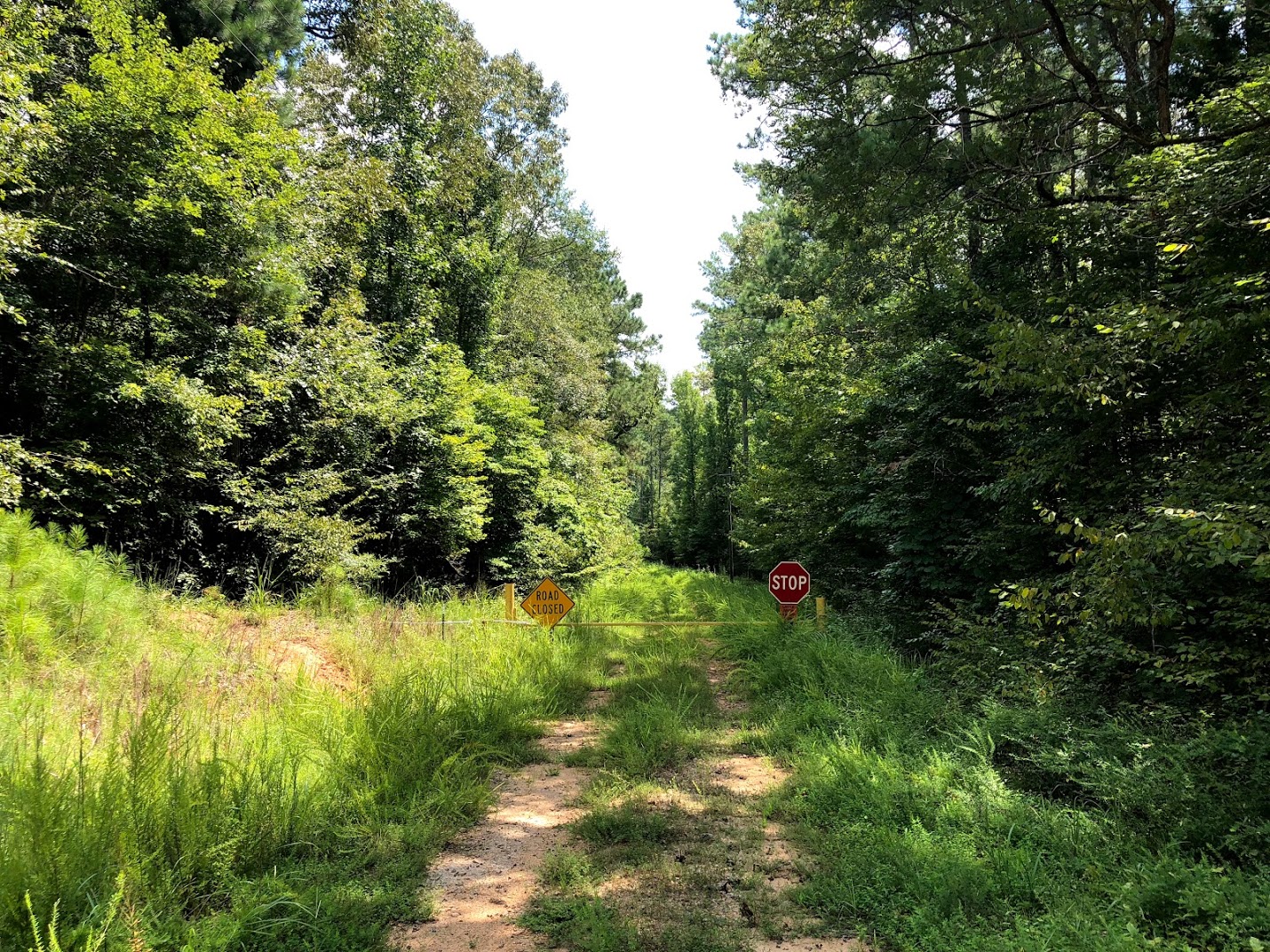
– After lunch I headed across Highway 60 to Coopers Creek Rd towars Cooper Creek WMA (You’ll see the sign).
– From there you’ll hit Mulkey Gap Road and then will turn right on Duncan Ridge Road. There are no road signs so I trusted my Wahoo Elemnt Bolt with my loaded route.
– Once on Duncan Ridge you’ll climb to about 3,700′ and then you will reach Wolf Pen Gap on Highway 180.
– Turn right on Highway 180 and take it down to Lake Winfield Scott to Camp.
Lake Winfield Scott Campground:
– After talking with the camp host, I decided not to hang my hammock and to bunker down next to the wooden retaining wall. There was a 100% chance of rain and gusts of wind that held true to the forecasts. So bunkering down was a great idea.
– Although I was able to get a fire started it started to sprinkle around 6 PM, so I crawled under my DIY tarp and laid down for the night. I was able to fall asleep around 7ish and stay asleep to about 11 PM. From then on it was on and off sleep because of the rain, wind and discomfort of not having a sleeping pad.
– I woke up to temps around 30 degrees around 7 AM, and was surprisingly still warm in my sleeping bag.
Day 2 (11/19/2017): 25.1 Miles | 2,205′ Elevation | 3:50 Elapsed Time
– Left Lake Winfield Scott and turned left on Highway 180 towards Suches.
– I stopped at Wolf Pen Gap Country Store to refuel (coffee and a powerade).
– From there I turned left on Highway 60 towards Woody Gap, but turned right on Cooper Gap Road.
– From there I took my time and biked until Coopers Gap Rd and Gaddistown Rd intersection where the AT crosses the gravel road.
– There I descended from Coopers Gap and biked back to Jake Mtn Parking Lot.
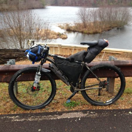
Items in my bags:
Seatbag: all in a plastic bag: leg warmers, long sleeve shirt, long johns, fleece gaitor, socks, cashmere sweater, beanie, thin gaitor, gloves, phone. (attached orange ankle bands to back)
Framebag: hammock straps, paracord, hammock, black tarp, two bags of pre-cooked rice, cliff bars, chocolate, tortillas, chips, fire starter (two fire cubes, bic lighter, matches), headlamp, handwarmers, instant coffee, spoon, plastic bag.
Triangle seatbag: bike tools, bike tube, battery packs
Tripod bag: tripod.
Bookbag: gimbal carry case, all camera equipment, handlebar mount, chest mount, down jacket, life straw and lid, toothbrush and wipes, first aid, wallet, keys, pocket knife, vest, fleece cycling jacket.
Handlebars: Sleeping bag on handlebars and reflective mat, cup.
Fork Mounted Bottle Cages: two water bottles.
Downtube: Frame Pump
Are you thinking about bikepacking?
-thebidon
Hi! Just got back last night from doing this loop. I live In NC now but it felt great to do my first bikepacking trip in the North Georgia mountains where I first began enjoying outdoor recreation.
My buddy and I decided to meet at the Deep Hole Campground on HWY 60 and begin our trip there. We started at 8am and pushed up to the Duncan Ridge Trail and then descended down to HWY 180. That was probably the funnest descent of the trip! We ended up pushing all the down to the Jones Dispersed Camping Area at the west side of the Jake-Bull Mtn area. We figure that first day had to be around 40 miles but didn’t track it so we aren’t certain.
Day 2 we rode from the camping area up to Winding Stair Gap and did that climb to the top and then enjoyed the easy ride down Rock Creek all the way back to the Deep Hole Campground. The second day felt significantly shorter so we were figuring it had to be between 15 and 20 miles.
Overall, for my first bikepacking trip, it was an absolute blast! Luckily, as it is only October we only had temps in the 40s at night so we didn’t have to pack to much extra winter gear.
Thanks for the detailed info on this loop and feel free to share any other loops with me! I am down for anything!
James, thanks so much for taking time to leave a comment and to let me know about your own Duncan Ridge trip. It’s cool to hear from someone else that has biked the same loop. Sounds like you and your buddy had a good time. The weather has been awesome the past couple of days. I bet it felt great. I can’t wait to get back up there.
What was your setup like? Tent or hammock. Also, what did you do for food and water?
-thebidon
Thanks for putting the video together.
I’ve done the Southern Cross route, Rock Creek Rd, swinging bridge and as far north as Aska but haven’t ridden Mulkey Gap, Duncan Ridge or anything further north and east. It was nice to see video of Duncan Ridge Rd. My hope is to get up that way before 2018 is over and your video is a help.
Thanks again.
-Tim-
Tim,
Thanks for taking the time to leave a comment and I’m glad you enjoyed my video. It is beautiful back there and is highly underrated and almost unknown to most people. There are some awesome routes back there. I hope you get out there before 2018. 👍
Cheers,
-thebidon
This is awesome.. New to bike packing, just getting my stuff.. Really want to do this loop. I’ve done Southern Cross many times and have often wondered about bike packing in the area.. I’m going to down load this route and try to get some friends to go with me.. Did you have to make a reservation at the camp ground? Also, what down jacket is that. I’m looking for one, but don’t know which models are great for packing down etc.. Thanks..
Thanks! No, I did not have to make a reservation, but if you’re going during the busy season check online first. If you can’t find one you can always disperse camp along the route.
It’s an Eddie Bauer Stormdown jacket. I bought it used on eBay and has served me well over the years. Fairly warm down to 45ish with just a shirt on underneath.
Enjoy your next trip!
Thanks for taking time to leave a comment 🙂