Oconee National Forest Trail Running:
Back on August 11th, I went over to Eatonton to do a little gravel running while my wife attended a shower. I decided to leave from downtown Eatonton to add a few miles to the run. From Eatonton I headed off towards a portion of the Oconee National Forest I found on Google Maps. After walking on the side of Godfrey Road I turned left on Martin Mill Road off of Godfrey Road. I assumed that Martin Mill Road was a public and open road. It was not. You will see in the slideshow below that it had a gate and a “road closed ahead” sign. I took it anyways. The gravel/dirt road was a little overgrown, but manageable all the way until the intersection of Martin Mill Lane and Road. About 200 yards before the intersection it was very overgrown, which required a lot of trekking through tall grass and weeds. Luckily, I did not pick up any ticks or chiggers.

From the intersection I kept running passing Burgess Road and down to Badger Creek. I ran over Badger Creek for only about half a mile before I turned back because of time. I wanted to reach Shady Dale Road but knew I didn’t have enough time, oh well. On my way back across Badger Creek I snapped a few photos of the chocolate milk like creek water and the bridge itself. Probably was the most scenic view of the day.

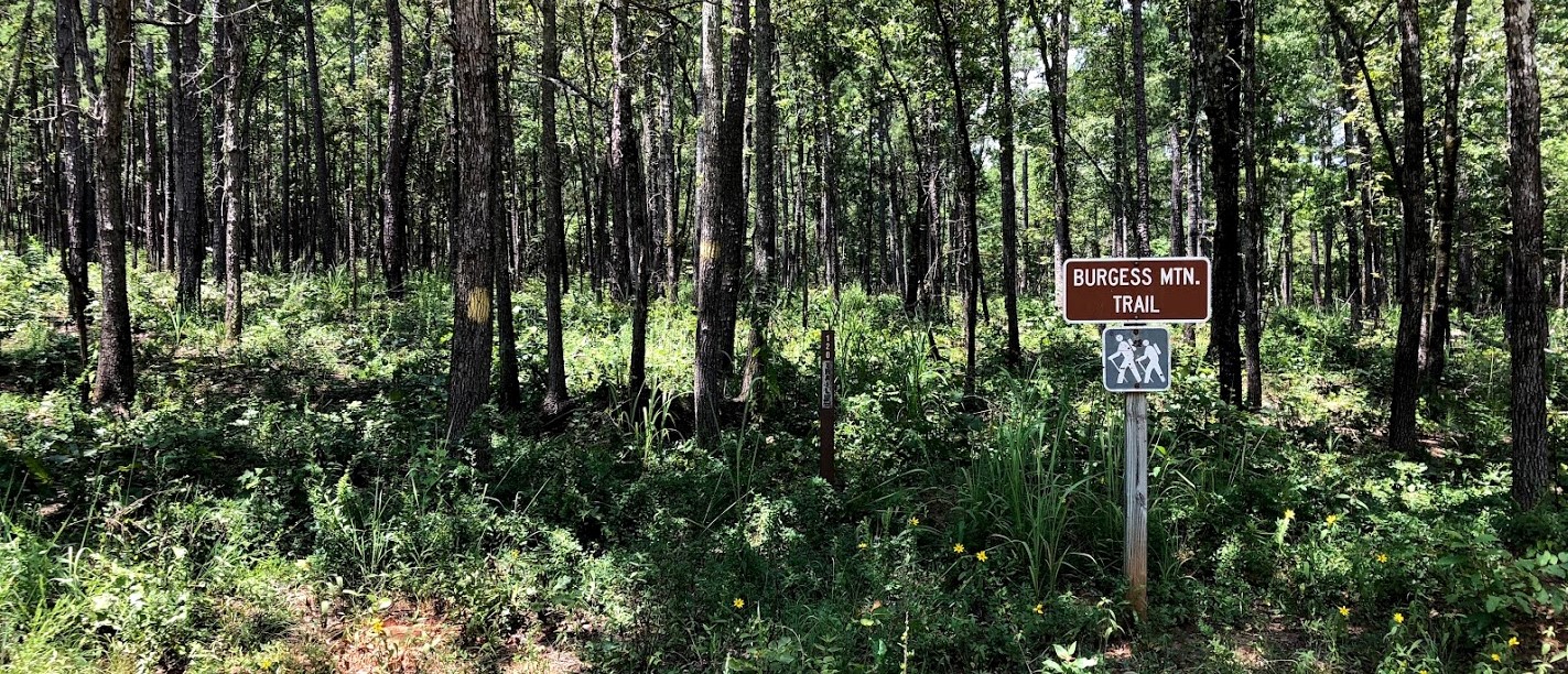
Once across the bridge and up the short little climb I turned left onto Burgess Road to head towards Burgess Mountain. Burgess Mountain is the highest point in the Oconee National Forest at 645 feet. There is a marked trail and a trailhead, but in August or any summer month the trail will be very overgrown. It didn’t look like anyone manages the trail during the summer. See for yourself in the picture below that I took of the start of the trail. After researching Burgess Mtn online I discovered they even have a summit marker, follow the link for the blog post (click here).

After passing Burgess Mtn, I made the decision to continue north to Godfrey Road. This ended up being a mistake. I knew that it would add a mile or two to the run, but I did not take into account how hot it was and how far away I would be from downtown (5 miles). I reached Godfrey Road rather quickly because it was flat and fast. But once on Godfrey it was anything but quick. I was left exposed hiking on the side of the somewhat busy country road, with little less than one bottle full of water. I rationed what I had left taking sips every 15 minutes. The thought of hitchhiking back into town crossed my mind multiple times.
I eventually made it back, fully exhausted and questioning if I could actually finish the upcoming 50 mile Rebecca Mountain trail race on September 8th. I should have taken notice of the effort that it took to just complete 13 miles that day. The RM 50 miler conditions ended up being very similar.
All in all, it was a fun day exploring a new national forest and doing some gravel running. It was great to disconnect and test the body in a new place. It provided the sense of adventure that i was looking for.
My Gear:
- Wahoo Elemnt Bolt GPS Cycling Computer
- Ozark Hydration Backpack
- Cascade Mountain Trekking Poles
- 2-Liter Hydration Pack
- 2x 25-Ounce Cycling Bidons
- 2x SOS Hydration Single Serve Packets
- 2x Clif Energy Gels
- Jelly Belly Sports Beans
Best Free iPhone Map App: Trails of the Chattahoochee-Oconee National Forests
I highly recommend this map app. The app downloads the map so you can use it without cell service. It contains all the trails, roads and points of interest in both the Chattahoochee and Oconee National Forests. I found Burgess Mtn using the app when scouting for a route.
Thinking about visiting Burgess Mountain?
-thebidon


