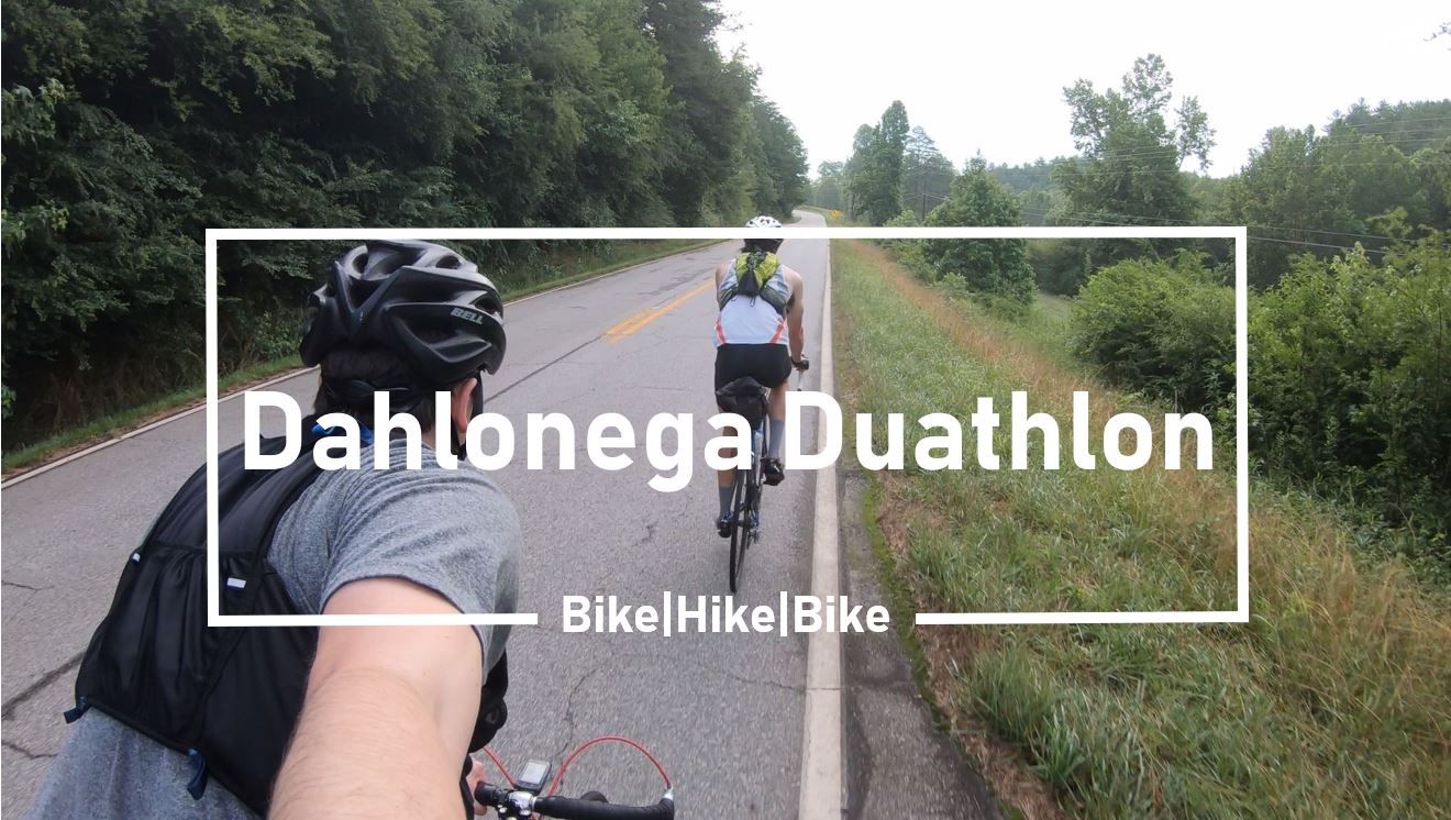
The unofficial Dahlonega Dualthon. Bike from Dahlonega to Neel Gap, hike from Neel Gap to the highest point on the Appalachian Trail in Georgia, Blood Mountain, and hike back to Neel Gap and finally bike back from Neels Gap to Dahlonega. All for a combined total of 48 miles and nearly 6,000 feet of elevation gain completed in about 6 hours.
The idea:
The idea originated out of the need to fill my buddy’s time while he was in town for the weekend. He threw out a few ideas like bike the entire Comet Trail, but the longer adventures we said no to because of my lack of fitness and the heat. He then came up with the Dahlonega Duathlon, likely influenced by Outside TV’s Beat Monday Episode 2, “Attempting the Unofficial Triathlon Jackson Hole Picnic”. We thought about throwing in a swim portion to make it a triathlon, but decided against it. All credit goes to my friend.
Below is a montage of sorts I created from the day. If you make if far enough into the video you’ll see us taking shots of Jim Beam on top of Blood Mountain and me almost get hit by a red sedan descending Neels Gap. Fun Times!
My Gear:

General Use Gear:
This is the gear I carried and wore during both the biking and the hiking portions. Almost all the biking gear I left in the DIY seatbag during the hiking leg. During the biking legs I stored my shoes, my running shorts, the bike lock, bike tube and bike tools in the DIY seatbag. That kept most of the weight off my back.
- Ultra-Tri Running Vest
- Wahoo Elemnt Bolt GPS Cycling Computer (for ride and run)
- Magene Heart Rate Monitor (Amazon & AliExpress)
- DIY Cricut theBidon Shirt
- GoPro Hero 7 (Mini Tripod and Extra Batteries)
- Wool Socks
- Sunscreen and Butt Wipes in a red ziploc bag
- Iphone 8
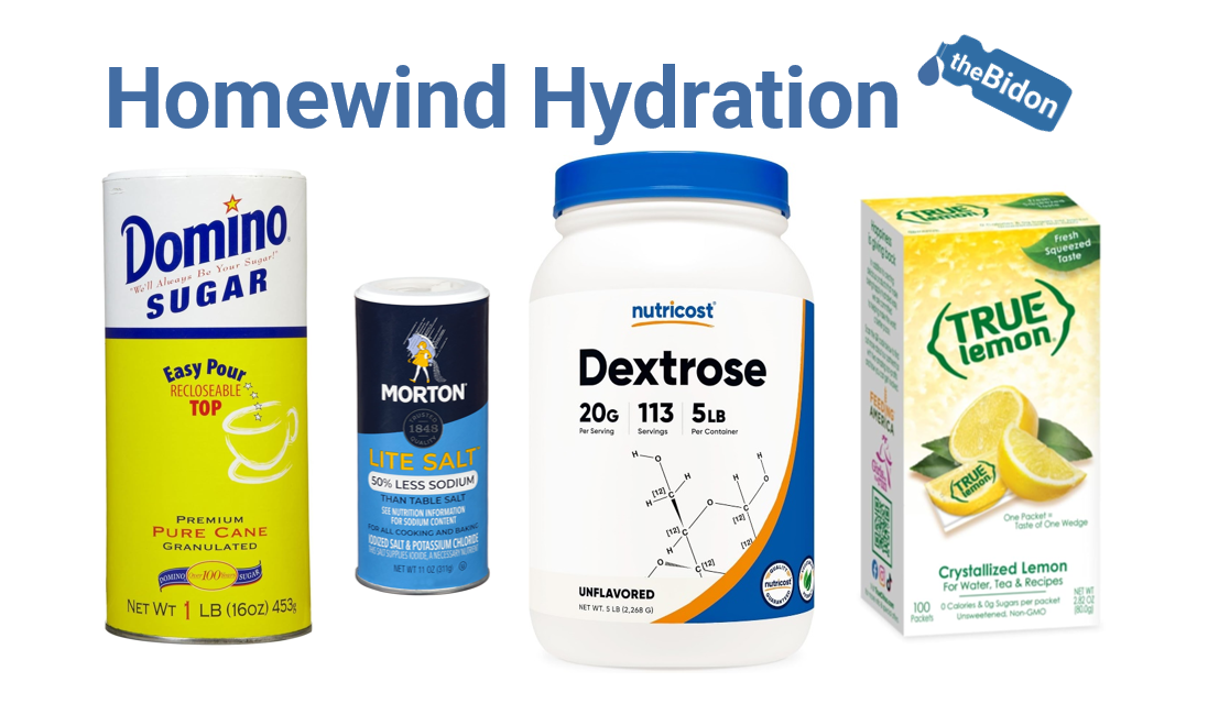
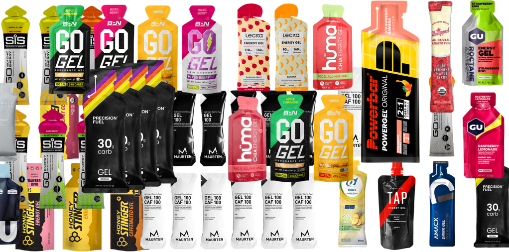
Nutrition:
Below is all the nutrition I carried for the day, except for the Coke I purchased at Mountain Crossings. I planned for it to be open and brought along a few dollars to purchase a drink. I consumed everything but two Clif Energy Gels. I should have taken them earlier to keep my electrolytes up, but lost my appetite for them and struggled the rest of the day with some cramping.
- 5 Gu Electrolyte Capsules
- 4 Clif Energy Gels
- 2 SOS Hydration Packets
- 2 Clif Bars
- 2 Shots of Jim Beam
- 1 Coke purchased at Mountain Crossings
Biking Gear:

- 1984 Trek 400 Road Bike
- Giro Carbide Mountain bike Shoes
- Bell Overdrive Bike Helmet
- Spexcel Cycling Bibs
- 1 Extra Bike Tube
- Bike Tools, patches and CO2 Pump and 1 Cartridge
- 1 Bike Lock for both of our bikes
- 1 Rear Bike Light
- 2 Bidons
Hiking Gear:
In addition to the general gear I carried and wore, I changed into my running shorts, laced up my Speedgoat 3’s and filled up my Ultra-Tri running flasks for the hike up to the top of Blood Mountain.
- Hoka One One Speedgoat 3
- Target 5″ Running Shorts
- 2 Ultra-Tri Running Flasks
Preface:
Before I dive into each leg of the duathlon, let me explain the process that took place before we pushed off on the first bike leg. The day started with us waking up at 4:30AM, Saturday morning at my house just east of Atlanta, GA. We knew the drive would be around 80 minutes so our plan was to leave around 5:30AM. That allowed us some time before pushing off at 7AM.
We did manage to leave around 5:30AM and made great time to Dahlonega. Parking is free during the weekends at the University of North Georgia so we grabbed a spot in the parking lot near the Mike Cottrell College of Business building. However, shortly after we parked, nature called and I told my buddy we needed to drive downtown to the public restrooms. I said a short prayer on the way for the restrooms to be open and they were at 6:50AM in the morning. Thank you, Dahlonega. We did our business. My buddy changed into his bibs and then we drove back to our spot near the business school.
Once back in the parking lot we took our time and geared up for the day. After filling our tires with air and our seatbags with our shoes, we pushed off for the day. Start time: 7:19AM.
The Stats:
Here are the stats from the day. The first picture is of my Fitbit Charge 2 heart rate data. I did use the Magene heart rate chest sensor, but it froze halfway up the climb to Neel Gap and didn’t work the rest of the day. I think it got too sweaty and lost connection. I noticed it on my Wahoo Bolt during the climb, but didn’t want to fool with it so I ignored it the entire day. Below the Fitbit data picture are the Strava stats, which were recorded on my Wahoo Elemnt Bolt. For the hiking portion I used the Bolt Sack. The Bolt Sack is a small sack I sewed together to hold the Bolt for running. Click here to read more about my design and to see some pictures of it on my Running vest (My post).


First Leg: Dahlonega to Neel Gap

Like I said above we rolled out of Dahlonega at 7:19AM. Dahlonega was a ghost town at that time in the morning. I guess all the weekenders hit the snooze button that morning. Although the road traffic along Highway 19 was calm we had already decided to avoid the long and slow climb to the bottom of Woody Gap by taking Leonard Pruitt Road and Porter Springs Road. Porter Springs Road drops you off somewhat in the middle on Highway 19 between the bottom of Woody Gap and Turners Corner (Neel Gap). About five cars total passed us before we got to Highway 19.
The beginning of the route along Leonard Pruitt and Porter Springs was a shock to my system. It consisted of short steep climbs, which got my heart rate going. It was there where I started to question my lack of fitness and if I would be able to complete the adventure. Before this day I had been running occasionally throughout the week but had not biked seriously since the fall of 2018. I knew if I took my time and kept my heart rate low I could finish the day. What I did’t know was how long my buddy would have to wait for me to finish and unlock my car for him.

After the short and steeps we jumped out on Highway 19 and continued along to Turners Corner. This part of the journey was uneventful as there are two or so small hills and then it is downhill to Turners Corner. I did stop along the way to pickup an Avia running hat laying in the middle of the road. I ended up gifting it to my friend halfway up Neel Gap because the added weight was really wearing me down.
The Neel Gap climb was a welcomed challenge. The constant force of gravity kept me focused and allowed me to slip into a distraction free mindset I enjoy. I did start to fade halfway up the climb and stopped to pour a SOS Hydration packet in my bottle and gnawed on a Sierra Trail Mix Clif Bar. Before then I had only consumed water and two Clif Energy Gels.
With the nutrition I was able to grind my (39×26) up the latter part of Neel Gap and roll into Mountain Crossings around 9:30AM. I do want to add my friend was my domestique up the gap. He stopped when I stopped and provided a slipstream for most of the climb. His fitness level was and still is way ahead of mine.

So we pulled into Mountain Crossings at 9:35AM. The plan was to fill up our water bottles with their outdoor water spigot located on the patio of their overlook. I also changed into my running shorts while my buddy wore triathlon bibs so he only had to put on his trail shoes. We also locked our bikes and helmets using one cable lock to a road sign. You can’t park your vehicle at Mountain Crossings if you plan to do any hiking. The parking is for customers only. A guy while we were there yelled at a couple for doing just that. They didn’t seem to have a problem with our bikes. I’m sure we were the first people they have seen do this kind of thing. If it became popular they might designate an area to lock up bikes.
Side note: Their restrooms were out of service so I had to change out of my sweaty bibs into shorts using a porta potty. To make matters worse then they were because changing out of tight sweaty bibs are already a challenge in themselves. There were two yellow jackets flying around inside while I changed into shorts shirtless. I took my shirt off before I entered because my cycling bibs have the normal built in suspenders and there wasn’t a clean area to place my shirt within the porta potty. Too much information, I know. But now you know what I actually had to go through to just change into my running shorts.


Second Leg: Blood Mountain Summit and Back

Once changed and our running flasks filled with we jotted across the highway to begin our ascent of Blood Mountain (9:50AM). My friend wanted to set a standard for himself so he took off. He asked if I was going to come with him and I told him I was going to walk. I knew if I followed him again I would end up DNF’ing this self supported adventure like the Rebecca Mountain 50 Miler Trail Run (My Race Recap). On this adventure there wasn’t anyone rescuing me back if I dropped out.

So he took off and I continued to power hike my way up the mountain and filmed along the way. About halfway up my left hamstring started to lock up. It locked up after the rock stairs. I stood in place for about 15 or so minutes and downed a SOS packet. While standing there I didn’t move an inch as 6 different individuals/groups walked past me on the trail. I’m sure they were wondering why I was standing there, but my hamstring finally released and I continued my hike up.


The weather was surprisingly cool near the top. As you can see in the pictures above it was overcast at this point in the day and breezy. The temperature hovered around 66 degrees Fahrenheit and was quite chilly as we took in the view at the top.
My friend made it to the top about 20 minutes ahead of me. Little did he know I had been carrying two shots of Jim Beam to throw back to celebrate the halfway point in our adventure. While the shots went down easily, it was harder to keep them down than I expected. Five minutes after, I was breathing slow trying to prevent myself from puking. We stopped right before you drop back into the woods on the exposed granite so I could calm my stomach down before continuing. See below for the clip of us at the top taking the Jim Beam shots.
We took over time coming down the mountain. We walked all the way. There wasn’t any reason to run and waste energy. I needed to conserve so I would have walked anyways.
Third Leg: Neel Gap to Dahlonega

Back at Mountain Crossings I changed into my bib shorts and purchased a coke from their store. We also filled up our bottles again with their outdoor water spigot and took in the view for a few minutes.

12:21 PM: We mounted our bikes and descended down Neel Gap to Turner’s Corner. After turning right at Turner’s Corner to continue on Highway 19 the temperature jumped up around 95 degrees. It was hot and I knew it was going to be a drag to Dahlonega. So we stopped again the Turner’s Corner General Store to fill up my bottles. I’m glad I did because I used everything I had to stay cool and somewhat hydrated on my way back.


The slog back was tough for me. My buddy on the other hand would yo-yo out in front of me as I slowly grinded my gears. He thrives in the heat and humidity. I on the other hand can’t seem to handle it even with all the electrolytes I consume. I think it has something to do with how much I sweat.
I stopped five times between the General Store and Dahlonega. I could feel my core temp rising like it did during the Rebecca Mountain 50 Mile Trail Race so I pulled over to cool down and lower my heart rate. It helped get me back in one piece but slowed us down tremendously. In cooler weather and in better shape I could finish the same segment 30 minutes faster.
Finished, 2:00 PM: After stopping at the intersection in front of Walmart to cool down again I slowly climbed the final hill to the square. Adventure complete. It was tough. I wished I tried more of this dual sport activities while I was in college. I had more time back then and was in better shape. Maybe I can think of another adventure to kickstart my fitness.
Lunch: Pueblos Mexican Cuisine
Before leaving Dahlonega we stopped by Pueblos Mexican. The food was terrible even though I was starving. The nachos were lacking flavor and cheese. It was truly disappointing. Next time we will give El Jimador a try.


-theBidon
Disclaimer: The content above contains affiliate links. You know why I include them, to keep this site running and to make a little money. Just know I really appreciate you for being here on my site. You are an awesome person if you click the links or not.